
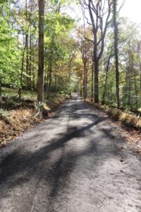
Old Carversville Road
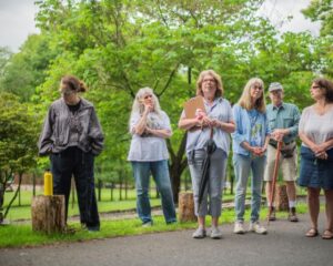
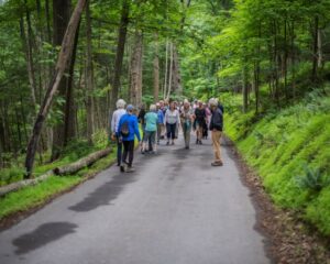
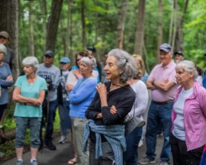
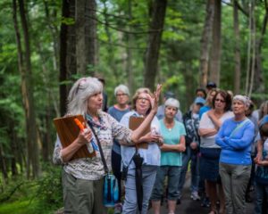
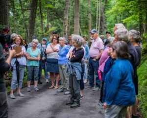
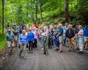
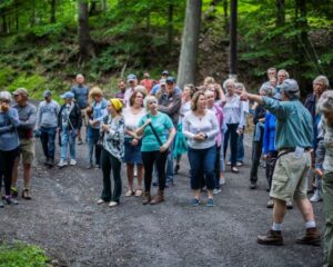
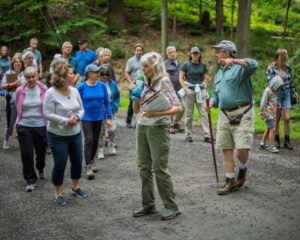
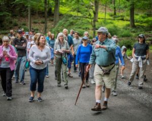
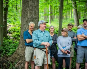
On June 13, 2021 the Brood X Cicada’s had just emerged after 17 years so we had an enjoyable walk to hear them sing and to learn a little history of this beloved road.
This poster was a door prize poster compliments of Friends of the Delaware Canal and Magicicada Design
The Story Behind Old Carversville Road
 During the 1730’s, Lumberville was known as Temple Bar. It had become, by then, something of a business hub as merchants worked their way up the Minski Trail along the Delaware River to procure the 140 foot/5 foot in diameter White Pine Logs coveted as masts in the King of England’s ship building industry. Much of the lower regions of the Delaware, indeed the whole most eastern coast, had already been clear cut of these valuable trees. So, the trees were cut up north and floated down the river towards the shipbuilding centers near Philadelphia.
The logs were floated down the river in huge flotillas called rafts, but the loggers/rafters(?) refused to risk the rapids below New Hope. The natural Eddy formed by the confluence of the Paunacussing Creek became the obvious place to unload. (The first mill shown on maps of this area is dated 1752, owner Stilton). Some say that these trees were coveted by the Brits that they would claim thee straightest and biggest for the king by marking them with his 3 axe mark trident and that this as much as tea was cause for the Revolutionary War.
Meanwhile, the farmers of Milton (now Carversville) with its fertile farmland (stolen from the Lenni Lenape Indians) had grist mills powered by the Paunacussing Creek (Paquessing being Lenape for “place where we were given powder”) had vegetables, flour and meal that needed a wider clientele. They were eager to get their produce to the merchants from Philadelphia gathering here along the river. So, they carved a road along the steep hillside protecting the creek thus connecting the two villages.
Credit: Story by Melody Hunt
The road is steeped in history….By 1740 the road on the Lumberville side or at the time called Temple Bar was owned by Josiah Winter who had purchased it from a remaining mineral speculator. He in turn sold it to a Revolutionary War Colonel, George Wall Jr., in 1775, and started calling Temple Bar, Wall’s Landing. George Wall built his house, known as the Red Mansion, on this rise overlooking his mills down by the creek.
By 1850, the Red Mansion had been razed and replaced by the much grander home of Lukens Thomas who built a sash and blind factory and bought a large amount of land up on the hill to the west of town.
William and Joseph Dillworth, bought George Wall’s sawmills in 1814, and built a house in 1815, which then was acquired by another mill operator, Jacob Fretz.
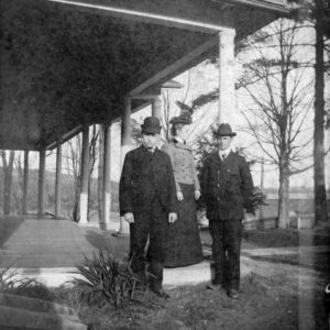
Photo Courtesty of Bill Tinsman: Lukens Thomas House circa 1890 with William Tinsman and Aunt Rebe
It is Fretz that is accredited with planting these wonderful trees in about 1850 on Old Carversville Rd. A rare Italian Chestnut tree has stood the test of time! As has a huge Ginko, the largest in Bucks County. The Oriental Spruce and the Nordman Fir are over 100 feet tall, and recognized as two of the largest and oldest of their kinds in PA! The extraordinary Umbrella Magnolia graces the a side yard.
There is a building (barn) that also dates back to at least 1850 and is an excellent example of an old Bucks County Barn and shows off it’s Germanic heritage with the striking round stone pillars. Next door to it, further up the road there was an even older building called The Grainery.
In 1986 The Grainery had to be taken down to make room for a large warehouse. In doing so, it was discovered that hand chiseled mortice and tenons on the beams were identified with two sets of Roman numerals each. This meant that it had been taken down and moved once before. And there was a foundation up the road that was the exact same size.
The first William Tinsman purchased the lumber business and his property et al from Lukens Thomas in 1869 and it has been passed down through the generations to this day. So far, 7 generations of Tinsmans have lived on this road.
The Hope House
George Sotter Painting Titled, “Hope House at Lumberville, PA”
There is a house down a driveway along the road that was the subject of a painting by
the artist George Sotter. It has a very interesting backstory as a woman from Maryland had rescued the painting from her mother’s trash and has
had it all these years. It was a gift from the Sotter’s to her Great Aunt and is called the “Hope House in Lumberville” in Sotter’s writing on the back. The woman contacted the Historical Society to ask if we know where the house was? The whole town of Lumberville was actually in on the search to no avail until our very own (Board Member) Melody Hunt was
reading a book of historical fiction about the PWAP muralists (Public Works Art Project of 1934) and people who were trying to get relatives out of Europe during Hitler’s reign being considered Communists at the time.
Melody said, “I knew of stories of an old “Communist Camp” held in a barn at this property during the 1930’s, so I compared the images of their beautiful old house (far back in the woods) and the Sotter painting and there it was. Then my husband, Bill Tinsman searched “Communists in
Lumberville” and found a wonderful story called “Growing up Communist in the 1930’s” and Lumberville was featured in a paragraph about the lovely camp where the workers/refomers would go to relax and recharge. This is the excerpt below.
Credit: Story written by Melody Hunt
Workers International Relief from “Growing up Communist in the 1930’s”
Meyer participated in a variety of projects sponsored by the
Communist organization in the Philadelphia area in the 1920s. One
project involved creation of a summer camp for workers and their
families called WIR. (Workers International Relief). Located on a
steep, wooded hillside above Lumberville, Bucks County, a tiny
village on the Delaware River, the camp provided workers with an
inexpensive place to rest and restore their energies. In the late 1920s
and early ’30s, it was a popular site among Party members and
sympathizers for summer vacations and weekends.
I had great fun at the camp. Even though I was under the age of five,
I participated in large-scale group games and helped members of
the Young Communist League collect wood in the surrounding forest
for nighttime campfires. I particularly enjoyed splashing in the
Delaware River literally in the shadow of the old covered wooden
bridge that connected Lumberville to New Jersey at the time. Meyer
managed the camp on a part-time basis from the time he and a
group of comrades established it until it closed for financial reasons
in 1933. Skilled in working canvas, Meyer made the tents we lived in
at WIR. A photograph taken at the time shows Esther and Meyer
sitting and holding hands under the tent’s canopy on the wooden
floor to which it was staked.
My parents and their friends were at the camp in August 1927, the
night Sacco and Vanzetti, two immigrant Italian anarchists who were
convicted of murder in a Massachusetts robbery, awaited execution.
Part of a worldwide movement that opposed the conviction and the
death sentence on the ground that the two were being persecuted
because of their radical opinions, they joined thousands of
Americans in maintaining a vigil in hope that the governor of
Massachusetts would cancel the execution. They walked down to
River Road, which borders the Delaware River, on the evening of Aug. 23 to use a public phone to find out whether a last-minute
appeal had succeeded. Both men were executed.
From a WIR document of 1934, the organization provided a three-
point program: “Solidarity and aid to the struggles of striking and
unemployed workers. To fight against misery and starvation of
working-class children. To unite neighborhoods for neighborhood
welfare.” It mobilized for food for strikers and their families,
sanitation, clinical services, and housing, free milk for babies, free
lunches for school children, free medical attention for the sick, and
all forms of social insurance, including unemployment insurance. The
influence of such radical demands can readily be seen in many of
FOR’s New Deal programs.
The Environment
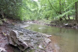
The Paunnacussing Creek
Since a lot of this land was owned by one family for generations, much of it is protected. That environmental acuity along with the same of a few likeminded neighbors, the steepness of the slopes, and ordinances enacted by the township, are combined to create the magical natural lands of Old Carversville Road today and the nearly pristine health of the Paunnacussing Creek below.
On the Lumberville end of the road the ridge above is an 80 acre farm that was preserved by Dan Tinsman of the greatest generation, through the Heritage Conservancy. (He gifted his development rights, you could also be paid for the rights by the township or county or one could deed restrict the property that one wished to see preserved.) So to the left of the road is preserved property. The other side is deed restricted and protected by the Tinsman Bros. Lumberyard’s history and heritage.
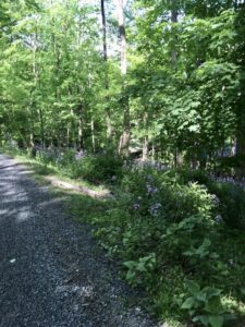
Phlox blooming along the road
As one walks along this stretch, you will notice the natural vegetation of the steep slopes, both up hill and down, (the Rhododendrons, the Christmas Ferns, etc.) and especially notice the Paunacussing Creek shining through the forest.
The Paunnacussing Creek is designated and protected as a High Quality Cold Water Fishery Supporting Trout AND the portion from beyond Carversville to the River is specifically included in the Lower Delaware National Wild and Scenic River Designation Act and the higher levels of protection granted therein. It is the only creek in Solebury Township to have that designation, with the Tinicum and Tohickon being the only other 2 tributaries included in this act. It’s a big deal. The very nature of Old Carversville Road with it’s unusual amount of natural land protects the Paunnacussing Creek and the priceless fresh water it holds. Future generations are depending on us to be mindful now. One mature leafy tree produces as much oxygen in a season as 10 people inhale in a year.” “A 100-foot tree, 18 inches diameter at its base, produces 6,000 pounds of oxygen.” “On average, one tree produces nearly 260 pounds of oxygen each year.
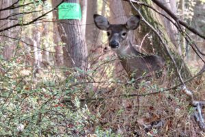
Deer enjoying a snack of belucci plants
Unfortunately, You will note that several of the indigenous trees have perished due to a kind of fungus, the ash borer and other diseases triggered by climate change. While it is of utmost importance to protect and nurture the surviving trees and saplings by minimizing invasive species and controlling deer populations, do let us point out the abundance of wildlife that has a home here and that the standing dead trees also play an important role in the cycle of life. Furthermore, while the phlox along the road has a short season, it thrives with the dappled sunlight and produces huge colonies of the beautiful wildflower through out this area.
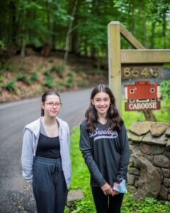
The Caboose
Everyone always wants to hear the story of how the Caboose got to Old Carversville Road. This is the story as I remember it. 1972, Easy Rider was a thing and young Tom Tinsman had hopped on his motorcycle for a cross country trip to visit friends. He had recently been gifted a piece of land by his parents, Bill and Sue Tinsman. While passing through Ohio he came across The Baltimore Ohio Caboose Graveyard. He saw the opportunity for a unique and almost ready built home. Bingo! He bought one for $800.00. They even agreed to stick it on the back of a train going to Phila. for free, it took 2 years but it did arrive. Now the problem was how to get it to Lumberville? This took about another year. The yard in Philly was getting a little impatient, but McHugh Bros Heavy Equipment Company and friend Albie Fetzer came through and for more than the caboose cost in Ohio, trucked the train car into the Tinsman Meadow. Once in the meadow the caboose still had a ways to go. So over a few month time period, using a 1938 Dodge Power Wagon, a small army of friends and 4 pieces of track (each weighing 100lbs per foot!), they literally constructed a railroad that leapfrogged up the old dam access/logging road eventually getting it to where sits today. Tom initially had a spring fed water tank for a tub and, of course, an outhouse for other personal needs. The realization that a lasting relationship was going require a little more elbow room (and maybe hot and cold running water), brought on the Silo a few years later. Hobart Myers had a farm on the hill on Ferry Road. On that farm he had a silo. E I E I O! Tom was, again, at the right place, at the right time. And the silo was his. Elmer Strouse Masonry lent him the round scaffolding to remove the silo ceramic tile by ceramic tile, launching them from the top down. (they were splined together with California redwood 5/8 inch in diameter splines 20 feet long. Down it came and back up it went. His brother, and friends built him the covered bridge as a wedding present! So, the silo did the trick!
The Story about the Doan Brothers
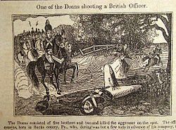
Wood Carving of Doan Brothers courtesy of Wikipedia
All of us have heard stories about the Doan Brothers Gang. Some true, some not. That’s how local lore gets passed down. Right? The 5 Doan brothers and a cousin were raised as Quakers but became Tory sympathizers during the Revolution and outlaws over taxation disputes with the new Patriot run local government. They broke in and robbed the County Treasury in Newtown and basically terrorized the local farmers of Central Bucks for several years. Oh, by the way, our George Wall from down the road in Wall’s Landing was the County Sheriff for much of the same time. (1779-1782) during that time one of the Doan’s was caught and hung, but this story is about the ones who got away…..There was an intersection of the old Paquessing (Old Carversville Road) and Sugan Roads (They do not intersect today). It went straight down the steep slopes and veered to the left crossing the Paunnacussing Creek at an angle to join up with a dirt track that led to Milton (Carversville) or straight up to the steep, stone cliffs that flanks the creek for most of its length on the far side.
The Doan Brothers were known to love those cliffs. The nooks, crannies and caves up there were among their favorite hide-outs. Their horses were agile athletes, more goat than mule, more race horse than plow horse. And so on numerous occasions, with (for all we know) our Sheriff Wall and his constables giving chase on draft horses, no less, the Brothers disappeared like ghosts into the rocky face of Plumstead Ridge. Thus giving the Doan Brothers the mystique we love to wonder about today.
There is a house on Old Carversville Road now known as the Raymond Charles Emerson House. Prior it was known as the “Ghost House” as the House went into ruins in 1937 and remained in ruins until 2001 when it was meticulously restored to its original standing by its current owners. It’s original stone structure was completed and in 1840 a wooden structure was added. The wooded addition was destroyed somewhere between 1937 and 1947.
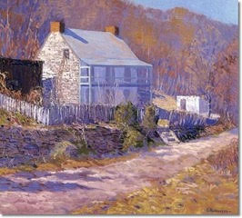
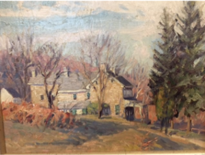
Painting by Kenneth Nunamaker “The Road to Carversville” circa 1920’s
Genealogy:
Proprietary Commissioners to
- Joseph Pike, in 1702 and consisted of 416 Acres.
- Joseph Pike to Ebenezer Pike (son) in 1714 with 416 Acres
- Ebenezer Pike to Richard Pike (son) in 1724 with 416 Acres (Stone Structure was built during this ownership)
- Richard Pike to Yeomans and Bridget Gillingham in 1764 and the lot was divided into two lots of 208 Acres each.
- Yeomans and Bridget Billingham to Josiah Winter in 1773 with 89.9 Acres
- Josiah and Christian Winter to Jonathan Pickering in 1779 with 81.9 Acres
- Jonathon Pickering Estate to Elihu Pickering (son) in 1805 with 81.9 Acres
- Elihu Pickering to Joseph Carver in 1806 with 81.9 Acres
- Joseph Carver to William Goddard in 1839 with 81.9 Acres (Wooded Structure was built)
- William and Lavinia Goddard to Joseph Reading in 1840 with 81.9 Acres
- Joseph and Catherine Reading to Daniel Hayes in 1848 with 81.9 Acres
- Daniel Hayes to Franklin P Hayes (son) in 1897 with 17.6 Acres
- Franklin P Hayes to John Hayes (son) in 1898 with 17.6 Acres
- John and Harriet Hayes to Stephen and Poli Lehotsky in 1917 with 17.6 Acres
- Stephen and Poli Lehotsky to John and Susan Siran in 1919 with 17.6 Acres
- John and Susan Siran to Andrew Katrusik in 1919 with 17.6 Acres
- Andrew Katrusik to John and Susan Siran via sheriff sale in 1920 with 17.6 Acres
- John Siran to Charles and Mary Happ in 1935 with 17.6 Acres
- Charles and Mary Happ to Anne Moore (widow) in 1936 with 17.6 Acres
- Anne Moore to Lewis H Gordon in 1937 with 17.6 Acres (House was vacated and fell into ruin)
- Lewis H Gordon to Andrew and Marjorie Elliott 1982 with 7.6 Acres
- Andrew and Marjorie Elliott to Thomas and Jill Patterson in 2001 with 7.6 Acres
Current owners retain copies of all the deeds since ownership by Joseph Pike of County Cork, Ireland. Also included are all land maps of Solebury Township showing the original 416 Acres and subsequent division of the property to it s present 7.6 Acres.
Links:
Wood Magazine with great cover and story of White pines and the Revolutionary War
River Keepers20 ways to protect your stream and stream side property
Lumberville: 300 Year Heritage by Willis Rivinus, 2006.
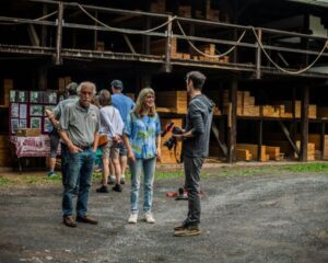
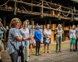
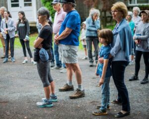
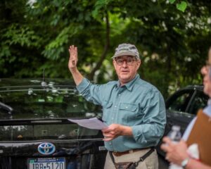
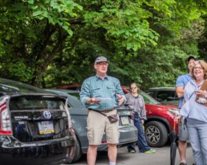
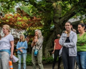
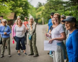
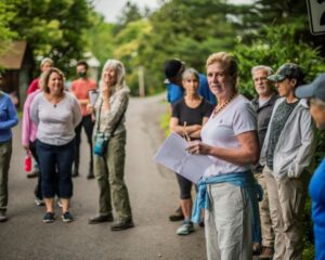
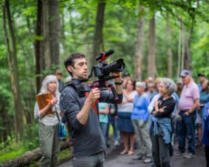
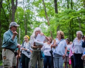
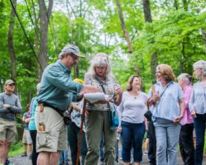
Photo’s of the walk-The following photo’s are courtesy of Kristina Gibb Photography

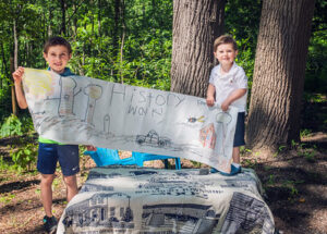
Residents, Connor and Brayden prepared a refreshments table in front of their home and made a banner for the occasion!

Holly Hawkins appropriately wore cicada earrings
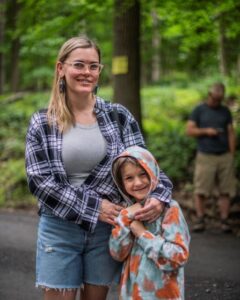
Holly Hawkins with her son Dante

2 1/2 year old resident, Brayden out for a bike ride. Photo courtesy of his mom!